Tue, 15 Sep 2020
Madeira is a fantastic place to try wild swimming. From natural volcanic swimming pools to serene freshwater bathing áreas. Discover these 16 unusual places to swim mostly in the Laurissilva forest.
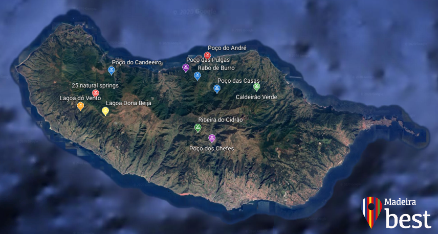
1. Poço das Casas - Boaventura
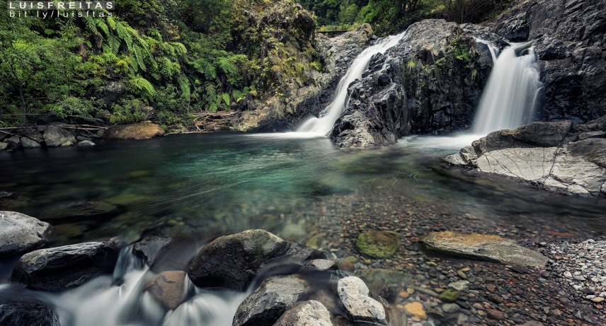
This natural pool is located in “Ribeira do Porco” (the pig’s river). The origin of its name is unknown but is probably due to the importance of these animals for the livelihood of the locals. The journey begins by crossing some houses and then, in the final descent, ends among vineyards. Before reaching the bridge, turn left and look for the best way down to the stream. It’s a short walk of 1 kilometer to go and back, on the way you will find the waypoints which will guide you to ‘’Poço das Casas’’ with a lagoon and Laurissilva surroundings. This pool is known as Poço das Casas (The Houses' Pool) but there are also inscriptions on the spot with references to Poça dos Namorados (Valentine's Pool).
Coordinates: 32°47'28.9"N 16°58'26.0"W
2. Poço do André - Boaventura
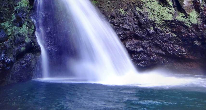 (Foto de: Luís Freitas)
This track will guide you along the Ribeira do Porco as well, but this one starts in the royal path, more precisely on the bridge next to the abandoned Ribeira do Porco Sugar Mill. This walk is 2.2 kilometers and it takes 1:15h but there is no trail and sometimes you have to cross the river several times that is why the difficulty of this track depends on the flow of the stream.
Coordinates: N 32º49.105, W016º58.063
3. Dona Beija lagoon - Rabaçal
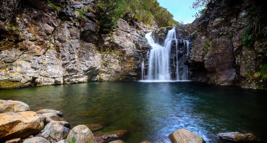
This lagoon must be made via the Levada do Alecrim and is one of the favorites for walkers who visit Madeira. After walking about 3.4 KM, you arrive at “Dona Beja” Lagoon, as well as other small surrounding lagoons, where you can relax whilst you enjoy the beauty of the natural landscape of Madeira. It takes about 45 minutes down the road, and it is almost always made flat. The small waterfall leads to the lagoon, which will then feed the large lagoon along the route ‘’Lagoa do Vento’’, which in turn feeds the 'Risco' waterfall. This lagoon was built with the aim of capturing and transporting the river waters of Lajeado and Alecrim to the water chamber of the Hydroelectric Plant of Calheta.
Coordinates: 32°45'12.6"N 17°07'57.5"W
4. Lagoa do Vento - Rabaçal
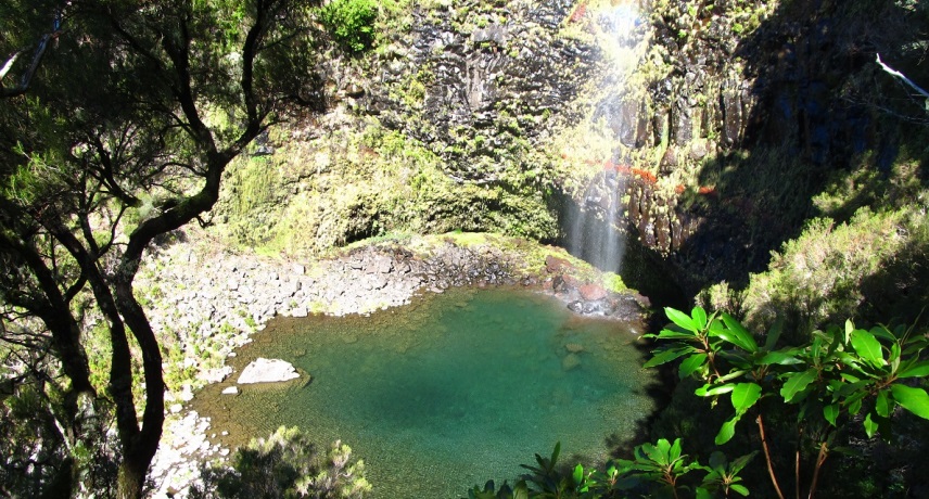
After 1600 meters walk, you arrive at a path with two paths, the one on the left leading you to the Lagoa do Vento and the right side path to the Levada do Alecrim. The left path leads you to this place, you shall walk 300 meters until you reach the majestic Lagoa do Vento.
When you finally reach the huge waterfall of 100 meters and Lagoa do Vento, stop and enjoy the sun and your picnic while listening to the powerful and calming sound of the water.
Coordinates:32°45'20.0"N 17°08'05.1"W
5. Poço dos Chefes - Nun's Valley
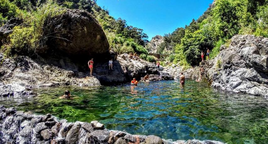
Located in The Valley of the Nuns (Curral das Freiras), this pool, Poço dos Chefes is a magnificent space in the middle of nature, surrounded by the Curral mountains and their grove created by locals and can be accessed by public buses directly from Funchal in under an hour.
Coordinates:32°43'03.6"N 16°58'09.8"W
6. Ribeira do Cidrão - Nun’s Valley
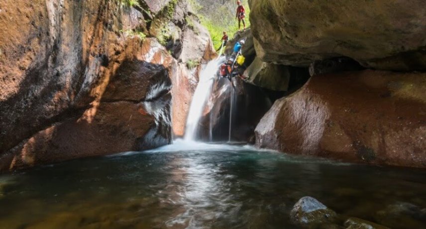
The beautiful Ribeira do Cidrão is located in the heart of the island of Madeira, in the valley where the nuns of the convent of Santa Clara escaped from Funchal when it was attacked by pirates in 1566, giving the name of Nun’s Valley.
You can park by the bridge and go up to 400m inside the stream until you find this beautiful place (approximately 30 minutes). Here you can practice Canyon as well and even combine this walk with the Poço dos Chefes.
Coordinates: N 32° 43.687, W 16° 57.839
7. 25 Natural Springs - Rabaçal
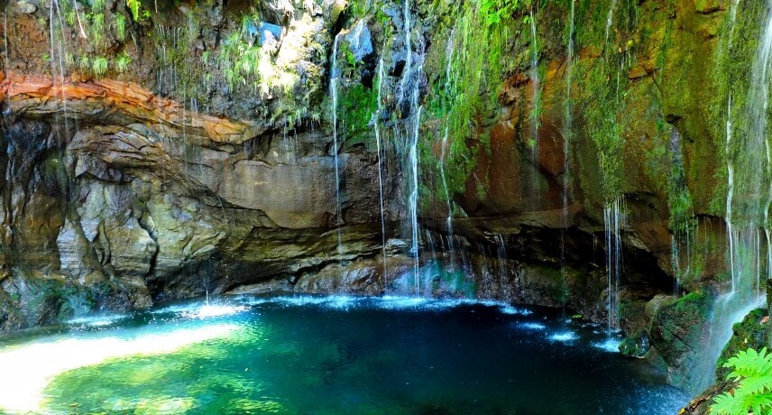
If you take the Levada walk PR 6, you can visit the lagoon of 25 springs, created by water coming down from Paúl da Serra.
Here you will find some species that are part of the Laurissilva forest of Madeira, classified as a World Natural Heritage by UNESCO. This Levada collects the waters of the tributaries of Ribeira Grande and goes to the hydroelectric power station of Calheta, followed by the irrigation of agricultural fields.
Coordinates: 32°45'52.4"N 17°07'37.3"W
8. Poço do Candeeiro - Ribeira do Seixal
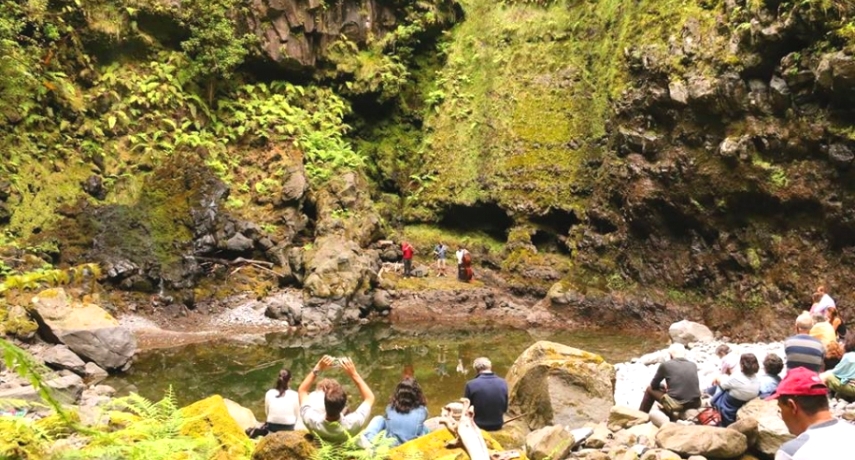
One of the beautiful secrets that Chão da Ribeira has to offer is located in Poço do Candeeiro, a small pond with a waterfall. When you get to Ribeira do Seixal just follow the signs and enter the stream bed and start a walk through the forest, the water is almost nonexistent and the stones are usually small, making this an easy and safe route. It’s about 0,58 kilometers but it goes unnoticed between the beauty of the Laurissilva forest. Sometimes in this place happens concerts called ‘’EcoMusicalis Lauraceae'', as we can see in the picture above.
Coordinates: N 32° 48.634, W 17° 6.944
9. Cascata do Rabo do Burro - Ponta Delgada
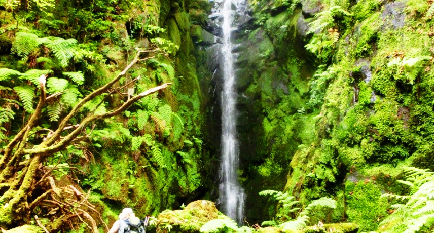
This place is a Madeira hidden treasure, in the middle of the forest. Your journey starts towards Lombada, where you can have a panoramic view of Ponta Delgada. Follow a cement road that rises along the valley and park near the end of the road. Cross ‘’Ribeira da Camisa’’ stream and follow a path marked on the west bank. This walk is about 6.6km. Progressing through dense vegetation and moss-covered rocks, we soon arrive at this beautiful waterfall.
Coordinates: 32°48'06.7"N 16°59'53.6"W
10. Poço das Pulgas - Ponta Delgada
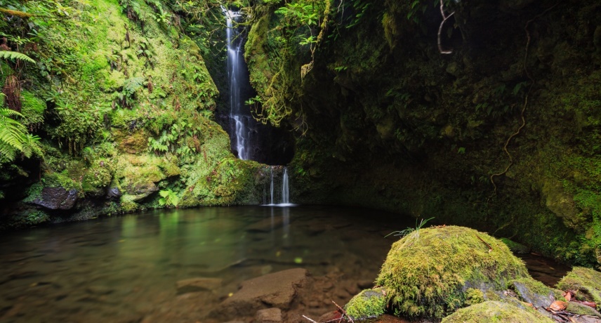 (Foto de: Francisco Gonçalves)
The Poço das Pulgas is located on the north of the island and is one of the most stunning and hidden spots in Madeira. This walk is 5 kilometers but is demanding with unevenness and it’s possible to combine with the Rabo do Burro Waterfall. On reaching the Ribeira da Camisa we come across a waterfall at our feet. Here, we climb along the stream of the river until we reach the beautiful lagoon Poço das Pulgas.
Coordinates: 32°47'57.1"N 16°59'55.0"W
11. Caldeirão Verde lagoon - Santana
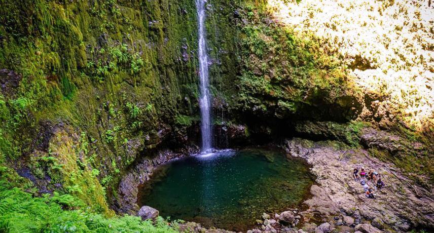
To get to this place you should take the Caldeirão Verde Levada walk, built in the 18th century, starts at the main bed of Ribeira do Caldeirão Verde and crosses escarpments and mountains, transporting the water that flows from the highest mountains on the island to the irrigation of the agricultural land in the parish of Faial. This walk is 13 kilometers After passing through the 4 existing tunnels along the route you arrive at the Caldeirão Verde lake, which is formed by the water from the bed of the Ribeiro do Caldeirão Verde at a height of approximately 100meters.
Coordinates:32°47'00.5"N 16°54'25.1"W

