Wed, 6 Oct 2021
On a visit to Madeira, it is essential to know its natural interior, walking along with one of its old irrigation channels, the Levada walks, which is the best way to find the most beautiful waterfalls. If you are a nature lover and would like to explore the Laurissilva forest give a look at these impressive places. But even if you feel like you are not into walking too much we selected four waterfalls near the roads.
1- 25 Fountains Waterfall, Rabaçal
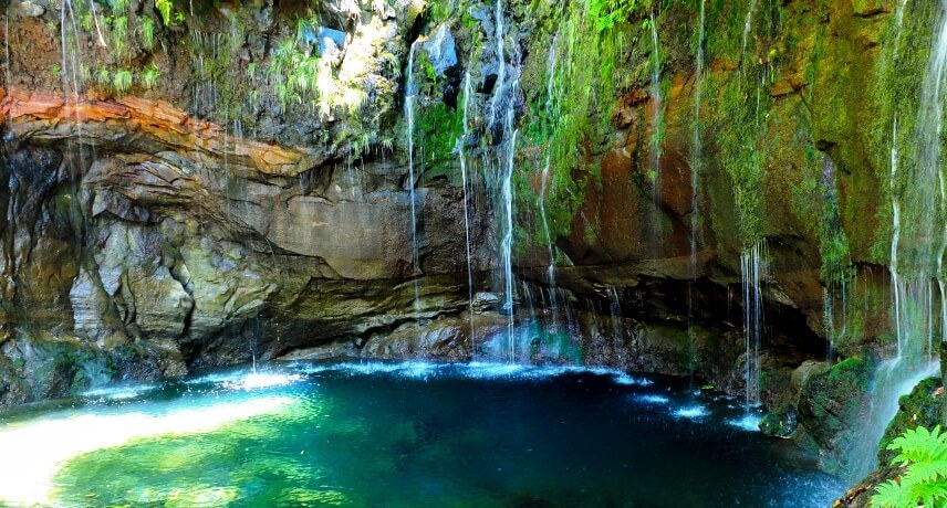
This waterfall is 30m high and consists of a group of waterfalls with different water streams coming vertically down the mountainside, Its name lives up to these little waterfalls that are possible to count once you arrive there. The access is made possible via the "Levada 25 Fontes", located in Rabaçal, within the primitive Laurisilva of Madeira forest. After arriving at the 25 Fountains delight yourself with the landscapes and the environment, such as the waterfalls and its lagoon where you can swim. This Levada collects the waters that come from the waterfall and feeds the hydroelectric power station of Calheta, followed by the irrigation of agricultural fields.
If you want to book a guided tour for the Levada 25 Fontes we've got you covered! Book Now
Private Transfer to Rabaçal for self-guided walk: If you want to do this walk by yourself, this transfer is the right option for you. BOOK TRANSFER
Coordinates: 32°45'17.6"N 17°08'01.9"W
2- Lagoa do Vento, Rabaçal
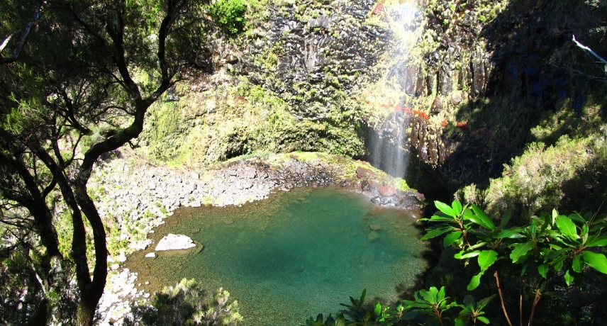
‘’Lagoa do Vento’’ can be accessed by walking Levada do Alecrim, also in Rabaçal, one of the most popular trails through the forest leading along water channel. Follow the Levada course until you reach the detour to the footpath that will take you to ‘Lagoa do Vento’. Walk down until you reach the magnificent lagoon with blue-green-colored water surrounded by stones. This lagoon is formed by the water which falls from the top of the cliff, coming from the Ribeira do Lajeado and moving towards the Risco Waterfall.
We also have a guided tour option for this walk, come check it out. Book Now
Coordinates: 32°45'12.6"N 17°07'57.8"W
3- Caldeirão verde, Queimadas
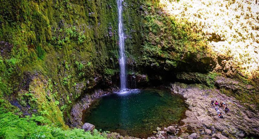
(Foto de: Gerardo Santos)
Levada Caldeirão Verde, also known as the Levada of the Green Cauldron, is located on the north side of the island and its name is due to a waterfall that looks like a cauldron you can find at the end of the hike. At this waterfall you can enjoy a picnic, sitting between the fabulous green of the Laurisilva forest, before embarking on the way back to the start of this walk at Queimadas.
The lake of the green cauldron is formed by water that crashes down along green rocks, at a height of 100 meters, and if you go here in summer, you might like to hop into the waterfall or even swim on the lake. You still can enjoy a picnic, feel the true nature of Madeira, smell the plants, and hear the birds singing.
Arriving at Caldeirão Verde you can continue the trail to another waterfall, Caldeirão do Inferno, where you will be greeted by a magnificent view over the village of São Jorge and the great mountains.
A guided tour is usually recommended for this one. Book Now
Transfer Caldeirão Verde Self-guided walk: Get your transfer for Caldeirão Verde walk selg guided hike and be amazed by this stunning Jurassic forest and unique waterfalls! BOOK THIS HIKE
Coordinates: 32°46'56.5"N 16°54'08.2"W
4- Levada nova waterfall, Ponta de Sol
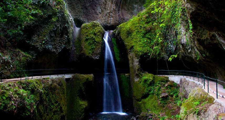
The Levada Nova waterfall is located in the Horta Lombada site, Ponta do Sol.
This waterfall gives rise to the stream of the same name and is included in a pedestrian path that extends through the Levada Nova area and allows observation of the endemic flora of Madeira island typical of Macaronesia. Its main goal was the supply of irrigation water to the lands between Ribeira da Caixa and Ribeira Brava, places like Zimbreiros, Candelária, and Lombo Cesteiro.
Surrounded by the green of the landscape, among the vegetation that covers the rocks and springs from the earth, there are several streams of water that flow into a translucent lagoon.
Here's the option for the guided tour. It's only a half-day walk, but well worth the extra information you get along the way. Book Now
Coordinates: 32°41'19.9"N 17°04'44.7"W
5- ‘Rabo de Burro’ Waterfall, Lombada
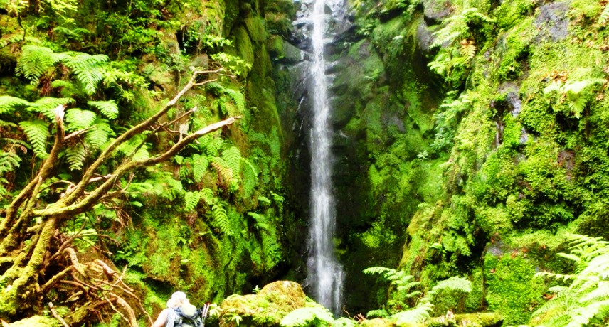
Drive until Ponta Delgada, and then up to Lombada, through this road, you can have a panoramic view over the village.
This walk is about 1.2 km, and starts at the end of the municipal road of “Cova do Bardo”, through the well-known path of the “poço das pulgas” (flea pit) in the middle of Laurissilva forest. When you reach the first level of the footpath, it diverges to the right in a downward direction, towards the root stream, then goes up, on the left bank (at the right side of the valley), progressing through dense vegetation and moss-covered rocks, we soon arrive at a beautiful waterfall.
If you want to check out more Trekking & Levada Walks click the following link. Trekking & Levada Walks
Coordinates: 32°48'17.6"N 16°59'53.6"W
6- Ribeira de Santa Luzia waterfall, Funchal
.jpg)
It all starts in the Funchal Ecological Park, wherein lies one of the major geographical units responsible for the distribution of water. The strong winter flows gather and infiltrate, which spring later generously to the lower levels in the cliffs that form the left side of the Ribeira de Santa Luzia, designated by springs of Tornos Altos.
This route starts in Monte, at Corujeira and it is called Rota da Àgua, due to its importance in the water ditribution in Madeira.
Through this centenary trail, we quickly arrive at Ribeira do Pisão with its emblematic bridge and waterfall, the Levada to the left leads us towards the Water Theme Center (Centro Temático da Água), while the ascent takes us to the galleries of Tornos Altos.
The more adventurous can explore the Ribeira de Santa Luzia going up its riverbed, and as a reward, and after 1,5kms, we have an impressive waterfall divided into two rebounds, one with 60 meters and the other with 90 meters.
If you want to check out more Trekking & Levada Walks click the following link. Trekking & Levada Walks
Coordinates: 32°40'59.0"N 16°54'45.5"W
7- Véu da Noiva, Seixal
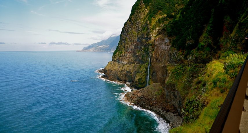
The Véu da Noiva viewpoint is located on the old road that connects Seixal to São Vicente Seixal and São Vicente and allows us to see its 30meteres waterfall and the north coast of Madeira Island. Its name comes from its height and the water load that gushes down the slope, looking like a bride's veil.
The Véu da Noiva is the suspended mouth of the João Delgado stream and resulted from a rapid retreat from the coast, in relation to processes of river incision by vertical erosion.
Only a small part of the runoff from this watershed is captured and transported by the Levada do Norte to the south coast of the island, the rest of it flows into the Atlantic Ocean.
If you want to check out more Trekking & Levada Walks click the following link. Trekking & Levada Walks
Coordinates: 32°48'57.7"N 17°05'42.8"W
8- Garganta Funda, Ponta do Pargo
.jpg)
(Foto de: Gregóire Breault)
The waterfall of "Garganta Funda" is located in Pedregal, Ponta do Pargo.
The access to the viewpoint is done on foot, over a small distance of 1,2 km, and the trail is made from the undergrowth in areas once dominated by vineyards, as evidenced by the old existing mill halfway through, dated 1935. As it is a short journey, it can be done calmly, enabling you to observe the quiet housing areas and the surrounding agricultural fields.
Garganta Funda is a 140m high waterfall, but remember to visit the waterfall during rainy seasons, otherwise, the waterfall will be almost dry during the summer months.
If you want to check out more Trekking & Levada Walks click the following link. Trekking & Levada Walks
Park your car here: N 32º49.154 / W 17º14.824
9- Água D’Alto, Faial
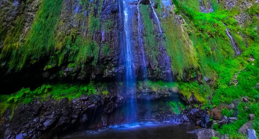
The Agua D’Alto Waterfall is located in Faial, Santana.
When reaching these coordinates, we can use the small road that has some space to park at the end. After you reach the top, go up some stairs through some houses and you'll reach the Levada. The walk is small and lasts about 10 minutes, but along the path, you can observe the cultivated fields and all the rurality of this locality.
On arrival we come across ’Ribeira da Abelheira’ with an impressive waterfall 150m high, coming from the highest points where extensive views of beauty can be admired.
If you want to check out more Trekking & Levada Walks click the following link. Trekking & Levada Walks
Coordinates: 32.775761, -16.870593
10- Anjos Waterfall, Ponta de Sol
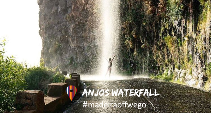
The Anjos waterfall is an exit of a mountain Levada, going over the old highway ER 101, in Ponta do Sol, where you will find it right in the middle of the road. It's a good stop to take a light bath in one of the secret corners of the island.
If you want to check out more Trekking & Levada Walks click the following link. Trekking & Levada Walks
Coordinates: 32°41'12.1"N 17°06'50.3"W

